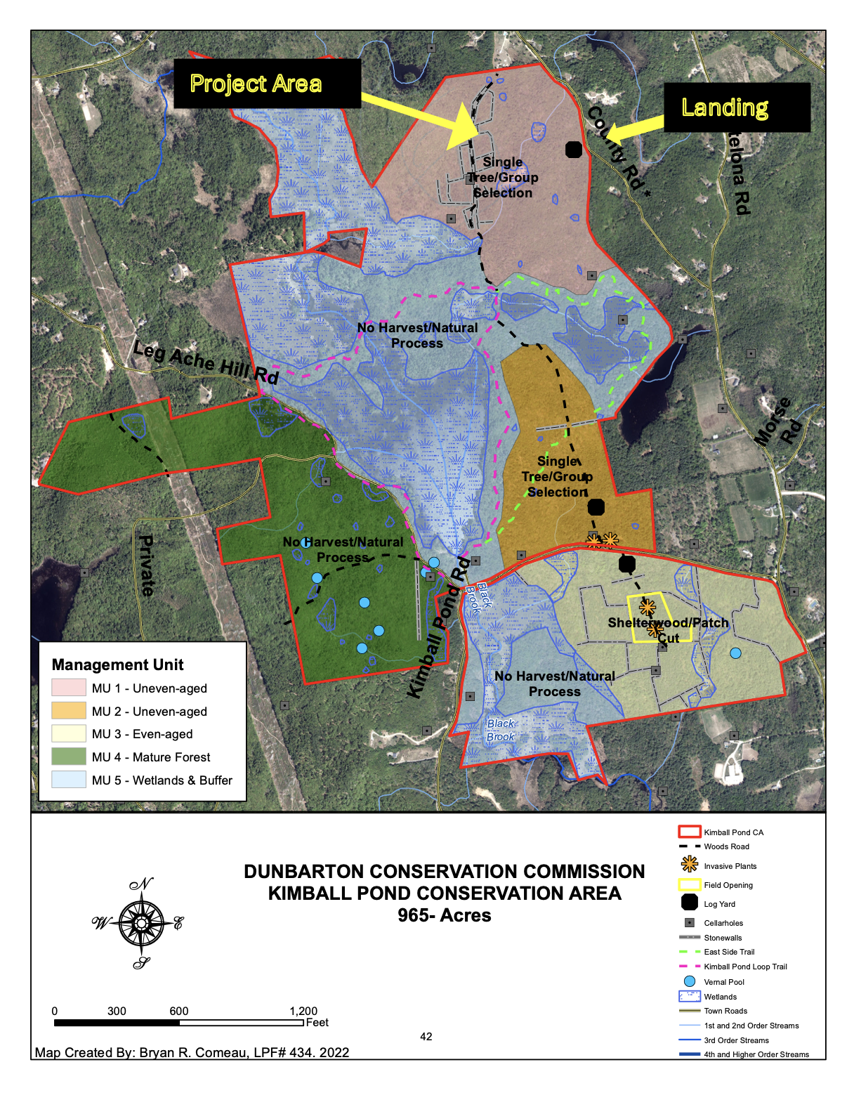
The Dunbarton Conservation Commission plans a sustainable timber harvest in a portion of the Kimball Pond Conservation Area that is accessed by County Road.
The harvest has been professionally planned and will be overseen for the Conservation Commission by a licensed forester who lives in town.
A fact sheet and map may be accessed by clicking here. The area to be harvested is indicated on the upper right corner of the map.
As background, the Town of Dunbarton received a $750,000 Forest Legacy Grant from the federal government more than 25 years ago to help purchase 650-acres of the now 1,000+ acre conservation area from a private party. The provisions of that grant, and our stewardship plan, require that we manage the 650-acres as a working forest.
Our focus with this is on best-practice, sustainable forestry to improve wildlife habitat. We are not clear-cutting the conservation area.
The timber harvest will begin in December or January, depending on the weather.
If you are interested in learning more, we are holding a site walk on Saturday, November 7 beginning at 9 a.m. at which our forester Bryan Comeau, Merrimack Country Forester Tim Fleury and UNH Extension Wildlife Biologist Matt Tarr will explain what is planned and what its effects will be on the forest and wildlife.
The site walk will begin at the logging landing (which is a small pull-out now that will be expanded before the harvest begins) which is marked by a black square on the map.